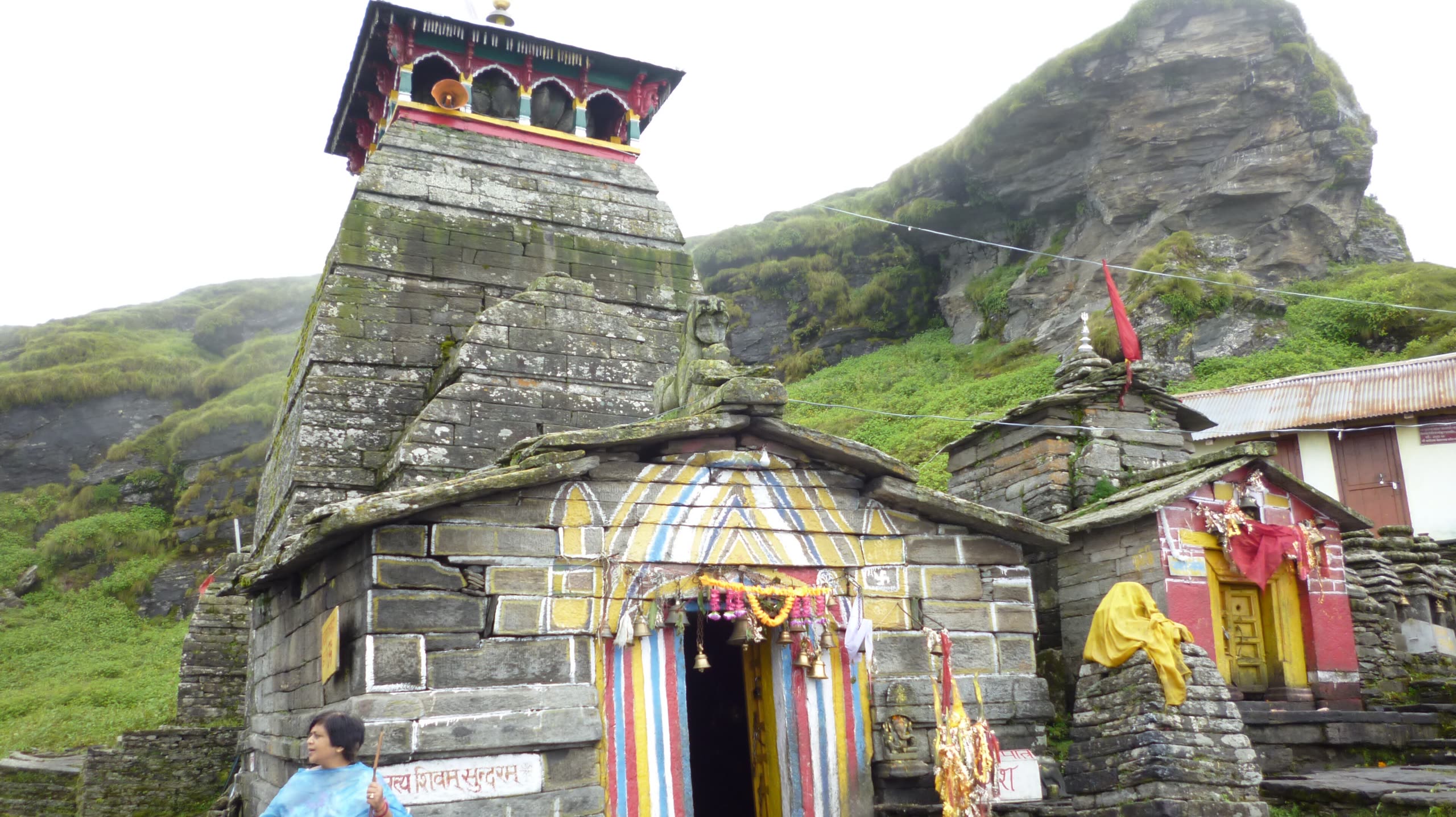
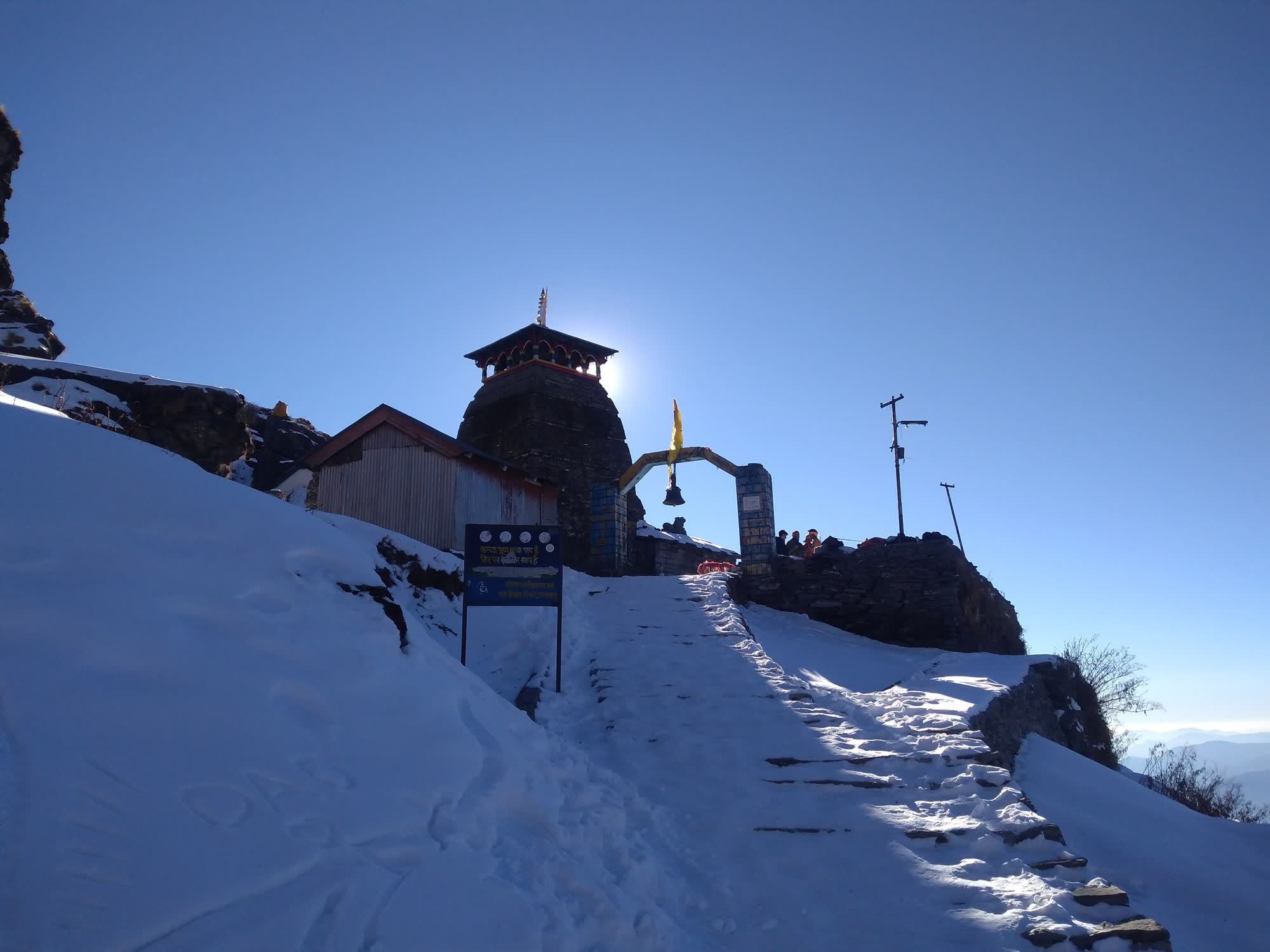
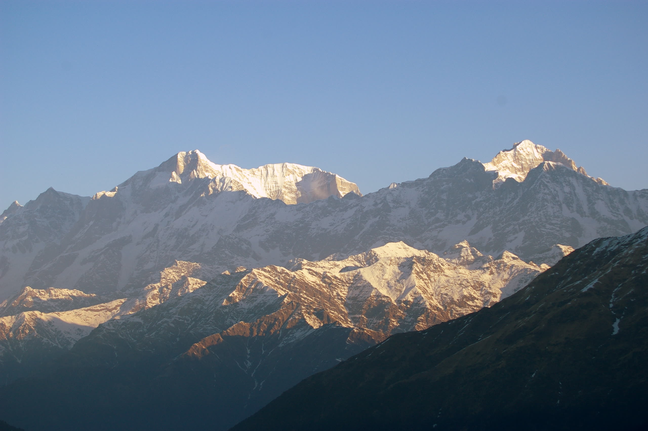
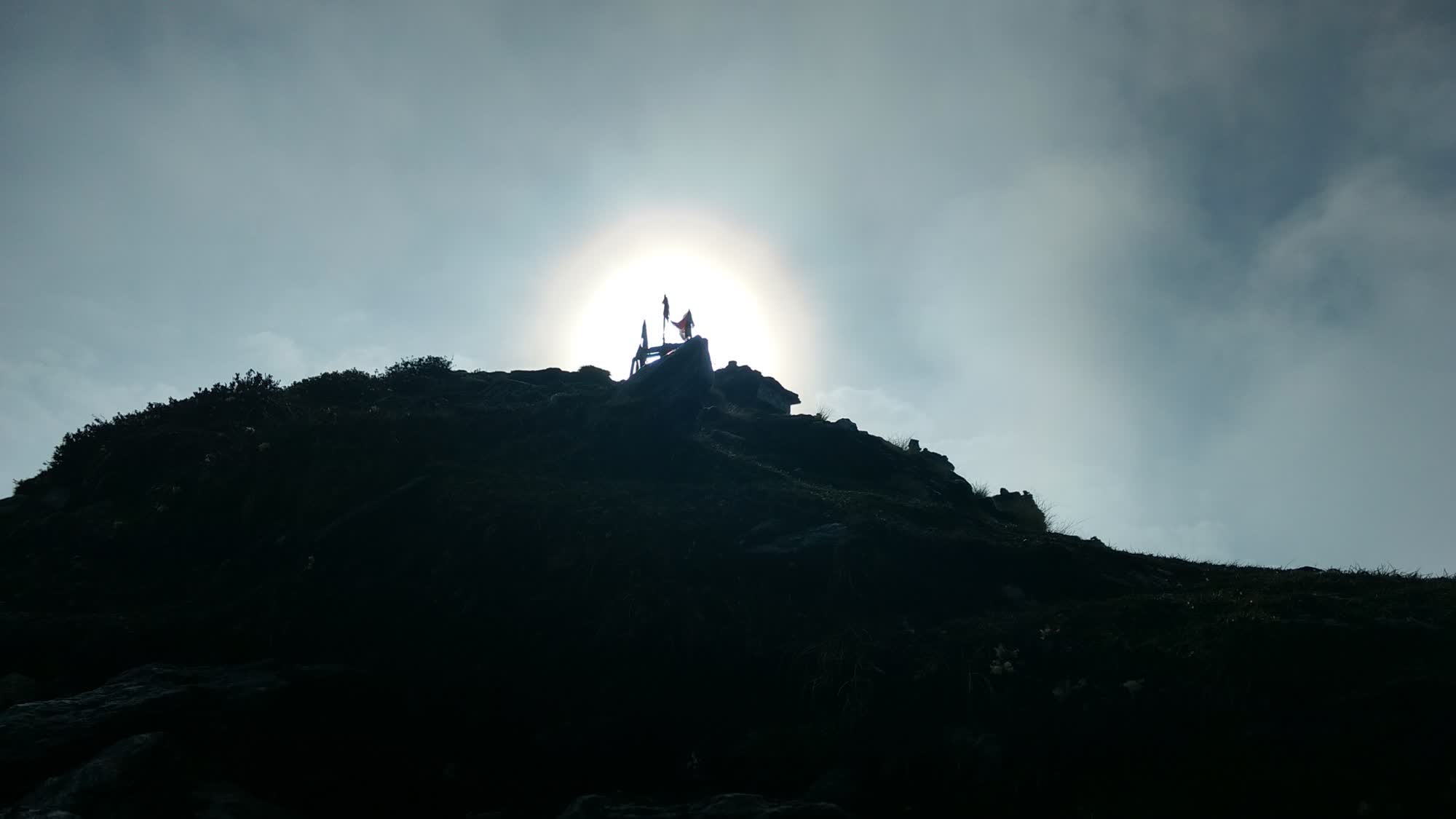
Traditionally called the highest Shiva temple in the world — a small stone shrine on a ridge above the Chopta meadows, looking out at a 200-km wall of snow peaks.
KedarThird Kedar
Part of ShivaArmsभुजा (बाहु)
Altitude≈ 3,410 m11,190 ft · often quoted 3,680 m
Trek≈ 3.5 kmfrom Chopta
DifficultyEasy – moderate
DistrictRudraprayagUttarakhand
Winter seatMarkandeya Temple, Makkumath
Season 2026Early Mayto Late Oct – early Nov
Tungnath — quick answers
Where is Tungnath?
In Rudraprayag district, Uttarakhand, in the Garhwal Himalaya. It is the Third Kedar of the Panch Kedar.
How high is Tungnath?
≈ 3,410 m (11,190 ft · often quoted 3,680 m).
Which part of Shiva is worshipped here?
Arms — The arms (bahu) of the bull appeared here.
How long is the trek?
≈ 3.5 km one way from Chopta (+ 1.5 km to Chandrashila). 2–3 h up · 1.5 h down. Difficulty: Easy – moderate.
When is Tungnath open in 2026?
Opens: Early May. Closes: Late Oct – early Nov. Winter seat: Markandeya Temple, Makkumath.
Rishikesh → Rudraprayag → Ukhimath → Chopta (≈ 210 km), or via Chamoli → Gopeshwar → Mandal → Chopta.
Last checked 13 Oct 2026 · Prepared by the Office of MushroomWale.com · Sources listed under “In detail”.
इतिहासHistory & significance
The arms (bahu) of the bull appeared here.
The arms of the bull appeared at Tungnath, which means “Lord of the Peaks”. Legend credits Arjuna, third of the Pandava brothers, with building the first temple. The present stone temple, about 1,000 years old, has a curved Nagara shikhara topped by a wooden roof.
Unlike Kedarnath, the priests here are local Brahmins from Makku village. In winter the deity is taken to Markandeya Temple at Makkumath.
A further 1.5 km above is Chandrashila, the “Moon Rock”, at about 3,640 m (often quoted as 4,000 m). Lord Rama is said to have meditated here after the war with Ravana, and the Moon god Chandra to have done penance here. The summit gives a 360° view of Nanda Devi, Trishul, Chaukhamba, Kedarnath and Bandarpunch.
Important points
Traditionally called the world’s highest Shiva temple. It is often quoted at 3,680 m, but terrain data puts it at about 3,410 m, below Kedarnath and Rudranath
Shortest and easiest of the five treks — ideal for families
Chandrashila summit (≈ 3,640 m): 360° Himalayan panorama — the highest point of the whole yatra
Chopta meadows — home of the Himalayan Monal, Uttarakhand’s state bird
About the altitude. Measured from SRTM satellite terrain data at the temple. The figure traditionally quoted is 3,680 m, which is close to the height of Chandrashila summit above it. Satellite terrain data is accurate to roughly ±30 m.
विस्तारIn detail
Tungnath, in full detail
The building and its worship, the festivals, the trail stage by stage, month-by-month weather, facilities on the way, and the customs to know.
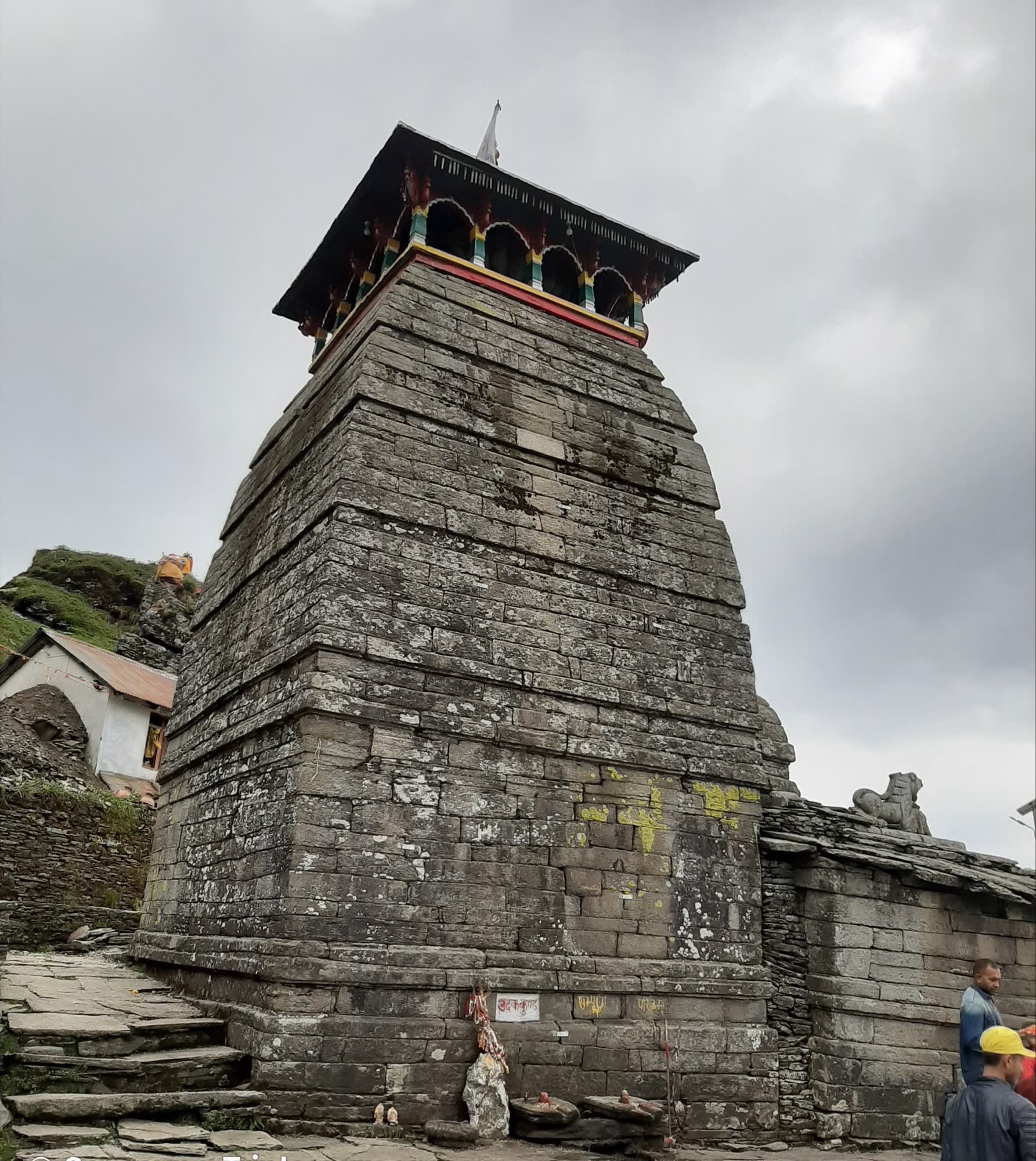
Tungnath is a small stone temple in the North Indian Himalayan style, close in form to Kedarnath. It is built of heavy stone slabs, with a curved Nagara shikhara topped by a wooden roof.
The garbhagriha holds the lingam, with a small mandapa in front and a stone Nandi outside facing the god. Around the main temple are several smaller shrines, including one to Parvati. Images of Ved Vyas and Kal Bhairav are also kept in the complex.
The daily round is a morning puja and aarti, darshan through the day with a short break for bhog, and an evening aarti.
The priests are local Brahmins of Makku village, not the South Indian priests of Kedarnath and Madhyamaheshwar. In winter the worship moves with them to Markandeya Temple at Makkumath.
The shrine is tiny and the queue can be slow on weekends. Remove shoes and leather outside and keep the sanctum quiet.
April (Baisakhi)
Opening date announced
The opening date is usually fixed on Baisakhi at Makkumath by consulting the panchang.
April–May
Doli yatra and kapat opening
The doli leaves Makkumath and climbs to the temple over a few days, usually halting at a shrine on the way and at Chopta. The doors open at the fixed muhurat.
Late October – early November (after Diwali)
Kapat closing
The doors close after Diwali. The doli returns to Makkumath for the winter.
February–March
Mahashivratri
Celebrated at the winter seat in Makkumath while the high temple is under snow.
1
Chopta → Trail gate
≈ 0.8 km+100 m
From the road, a paved path enters rhododendron forest. Shade and a gentle start.
2
Trail gate → Meadow tea stall
≈ 1 km+270 m
Steeper climb out of the trees onto open meadow. The first big views of the snow peaks. Tea and snacks here.
3
Meadow tea stall → Tungnath
≈ 1.7 km+360 m
The steepest part: tight switchbacks across open grass, with no shade. Benches along the way. The path is paved throughout.
4
Tungnath → Chandrashila
≈ 1.5 km+230 m
Optional. A rough, unpaved path climbs steeply to the summit. Can be icy or snowbound early and late in the season. No water or shelter.
-13°C16°C
Jan≈ −11°C / ≈ −2°CTemple closed. Deep snow; road beyond Chopta may be shut.
Feb≈ −10°C / ≈ −1°CTemple closed. Snow.
Mar≈ −7°C / ≈ 2°CTemple closed. Snow.
Apr≈ −3°C / ≈ 6°CSnow melting; opens late April or early May. Rhododendrons in bloom lower down.
May≈ 1°C / ≈ 11°COpen. Clear mornings.
Jun≈ 5°C / ≈ 14°COpen. Showers from mid-June.
Jul≈ 7°C / ≈ 14°COpen. Monsoon — cloud and rain most days.
Aug≈ 7°C / ≈ 14°COpen. Monsoon; green meadows.
Sep≈ 4°C / ≈ 12°COpen. Clearing skies late in the month.
Oct≈ −1°C / ≈ 9°COpen. Clearest views of the year; frosty nights.
Nov≈ −5°C / ≈ 5°CCloses after Diwali. Approximate.
Dec≈ −9°C / ≈ 1°CTemple closed. Snow.
Approximate temperatures at the temple’s altitude (night / day). These are not weather-station records.
Medical aid
No medical post on the trail. The nearest health centres are at Ukhimath and Gopeshwar.
Mobile network
BSNL and Jio usually work around Chopta and in patches on the trail. Not guaranteed.
ATMs & cash
No ATM at Chopta. The nearest are at Ukhimath and Gopeshwar. Carry cash.
Food on the trail
Dhabas at Chopta, tea stalls along the path and simple food near the temple in season.
Ponies / palki / porters
Ponies can be hired at Chopta for the ride up towards the temple. In peak season ask your camp or lodge to arrange one in advance.
Electricity & charging
Power at Chopta camps and lodges can be limited. Carry a power bank.
Toilets
Basic toilets at Chopta and near the temple. Few in between.
Drinking water
Carry water from Chopta. Tea stalls sell bottled water at higher prices.
Do
Start early; cloud often covers the peaks by late morning.
Carry warm layers even in summer; the ridge is windy.
Use a walking stick on the paved descent, which is hard on the knees.
Look out for the Himalayan Monal on the meadows, and keep your distance.
Don’t
Don’t go up to Chandrashila in snow or ice without proper footwear.
Don’t feed wildlife or leave food waste.
Don’t photograph inside the sanctum.
Don’t drive beyond Chopta in winter without checking the road.
How long does the Tungnath walk take?
Most people take 2–3 hours up from Chopta and about 1.5 hours down. Add an hour or more for Chandrashila.
Can I ride a pony to Tungnath?
Yes. Ponies are available at Chopta and go most of the way to the temple. They do not go to Chandrashila.
Why are the priests different here?
Tungnath is served by local Brahmins of Makku village, unlike Kedarnath and Madhyamaheshwar, where the priests are Jangams from Karnataka.
Is Tungnath really the highest Shiva temple?
It is traditionally called the world’s highest Shiva temple and is often quoted at 3,680 m. Terrain data puts it at about 3,410 m, which is lower than Kedarnath and Rudranath.
Based on: BKTC announcements as reported in the press (Baisakhi date-fixing, opening and closing) · Uttarakhand Tourism · Rudraprayag district website · Trek and travel guides (Indiahikes, euttaranchal.com and others) for trail facilities · Wikipedia (Tungnath) for cross-checking.
कथाएँThe legends
The stories of Tungnath
Traditional accounts, as told in the Puranas and by the temple communities. Versions differ from valley to valley.
The arms, and the archer who built the temple
At Tungnath, the “Lord of the Peaks”, the arms of the bull came up out of the earth. Tradition says Arjuna, the great archer of the Pandavas, built the first temple here.
The present shrine, about a thousand years old, sits so high that for most of the year it stands in cloud. A Nandi waits outside, facing the god.
Rama on the Moon Rock
Above the temple rises Chandrashila, the Moon Rock. Local tradition holds that Rama came here after the war with Ravana. Ravana had been a learned Brahmin as well as a demon king, and Rama meditated on this summit to atone for killing him.
The moon’s penance
The summit also takes its name from Chandra, the Moon. The Puranas tell how Chandra married the 27 daughters of Daksha but loved only one of them, Rohini. Daksha cursed him to waste away.
Chandra prayed to Shiva to be freed from the curse. Shiva could not undo it completely, so he softened it: the moon would wane and then grow again. Local tradition places part of Chandra’s penance on this rock, the highest point of the whole yatra.
Priests from Makku
At Kedarnath and Madhyamaheshwar the priests come from the south of India. At Tungnath they come from the hills. The priests here are local Brahmins of Makku village.
In winter the deity is carried down to their village and worshipped at the Markandeya Temple, Makkumath. It is named after the sage Markandeya, who in legend defeated death through his devotion to Shiva.
Each trail is traced from OpenStreetMap footpaths, and its height is measured every 20 m from satellite terrain data (SRTM). The hiker walks that real profile on a 3D satellite map. Speed comes from Tobler’s hiking function, adjusted for altitude, your pace and rest stops. At every step you see altitude, gradient, oxygen and temperature, and at the end the time you reach the temple.
Sunrise over Nanda Devi, Trishul, Chaukhamba and Kedarnath.
≈ 1.5 km above · ≈ 3,640 m
Deoria Tal
Lake that reflects Chaukhamba; linked to the Yaksha–Yudhishthira dialogue.
≈ 2.5 km trek from Sari
Kedarnath Musk Deer Sanctuary
Musk deer breeding centre on the Chopta–Gopeshwar road.
Kanchula Kharak
Ukhimath
Omkareshwar Temple and the nearest town with full services.
≈ 29 km
विश्रामWhere to stay
Stays for Tungnath
Camps and simple lodges at Chopta and Dugalbitta; hotels at Ukhimath and Sari; a few basic rooms near the temple.
Madhyamaheshwar · Tungnath
Ukhimath
GMVN Tourist Rest House
Hotels & guest houses
BKTC dharamshala
Indicative / night₹1,000 – ₹3,500
Hub for Madhyamaheshwar and Tungnath. Has ATMs, pharmacy and fuel.
Tungnath
Chopta · Dugalbitta · Sari
Camps
Cottages
Lodges
Deoria Tal homestays (Sari)
Indicative / night₹1,000 – ₹5,000
Chopta itself has camps and lodges. Dugalbitta has the better resorts.
सुझावPilgrim tips
Start by 4 AM if you want sunrise on Chandrashila.
The road beyond Chopta can close with snow from December to March.
The trail is paved but steep. Use a walking stick on the way down.
This website is managed by
The Office of MushroomWale.com
A free, independent guide for Panch Kedar pilgrims, prepared and maintained from Uttarakhand. Temple bookings and donations go only through official channels — this site never collects money.