Rishikesh → Rudraprayag → Ukhimath → Uniana / Ransi (≈ 200 km). Ransi is the road head.
Last checked 13 Oct 2026 · Prepared by the Office of MushroomWale.com · Sources listed under “In detail”.
इतिहासHistory & significance
The navel and middle of the bull — the lingam is navel-shaped.
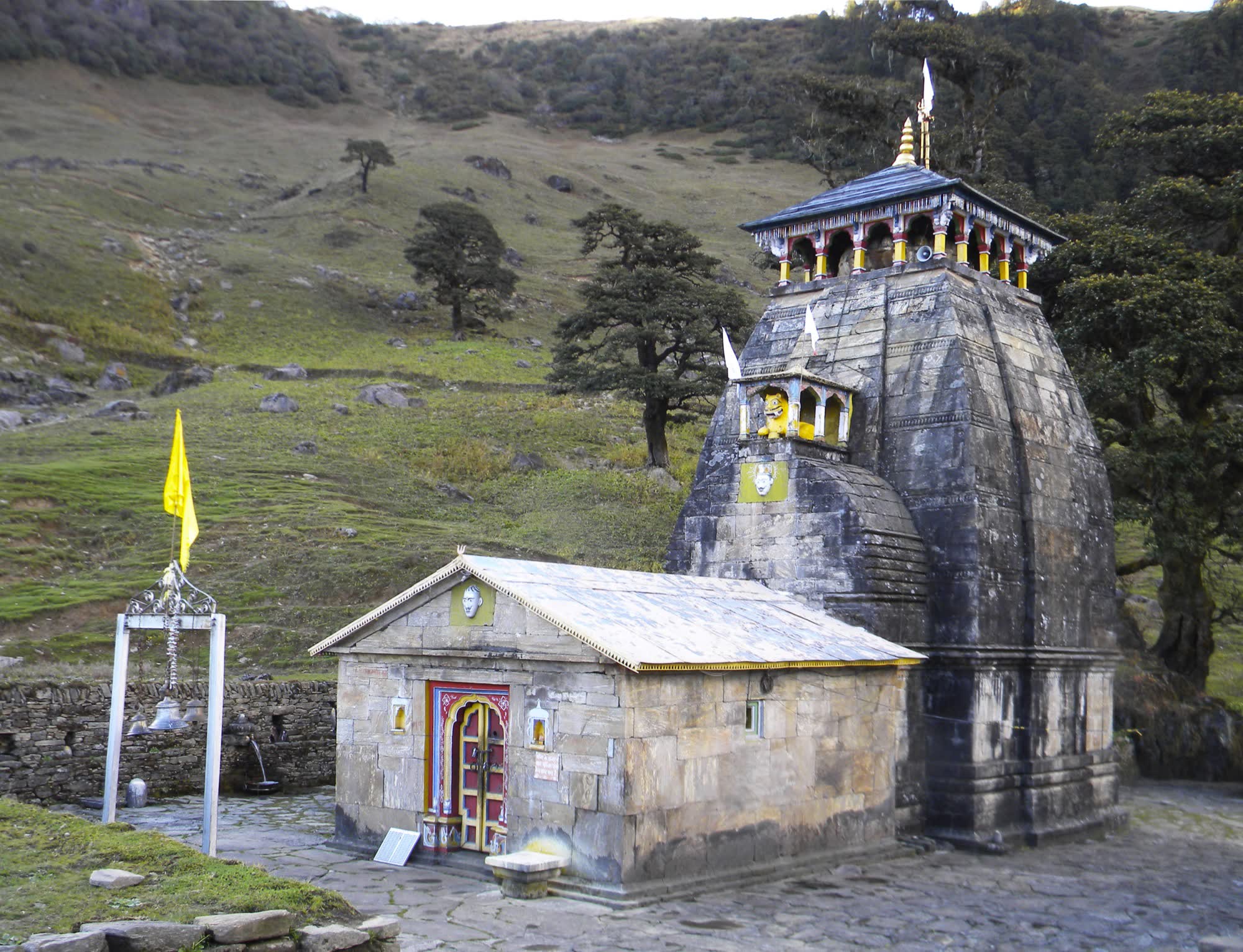
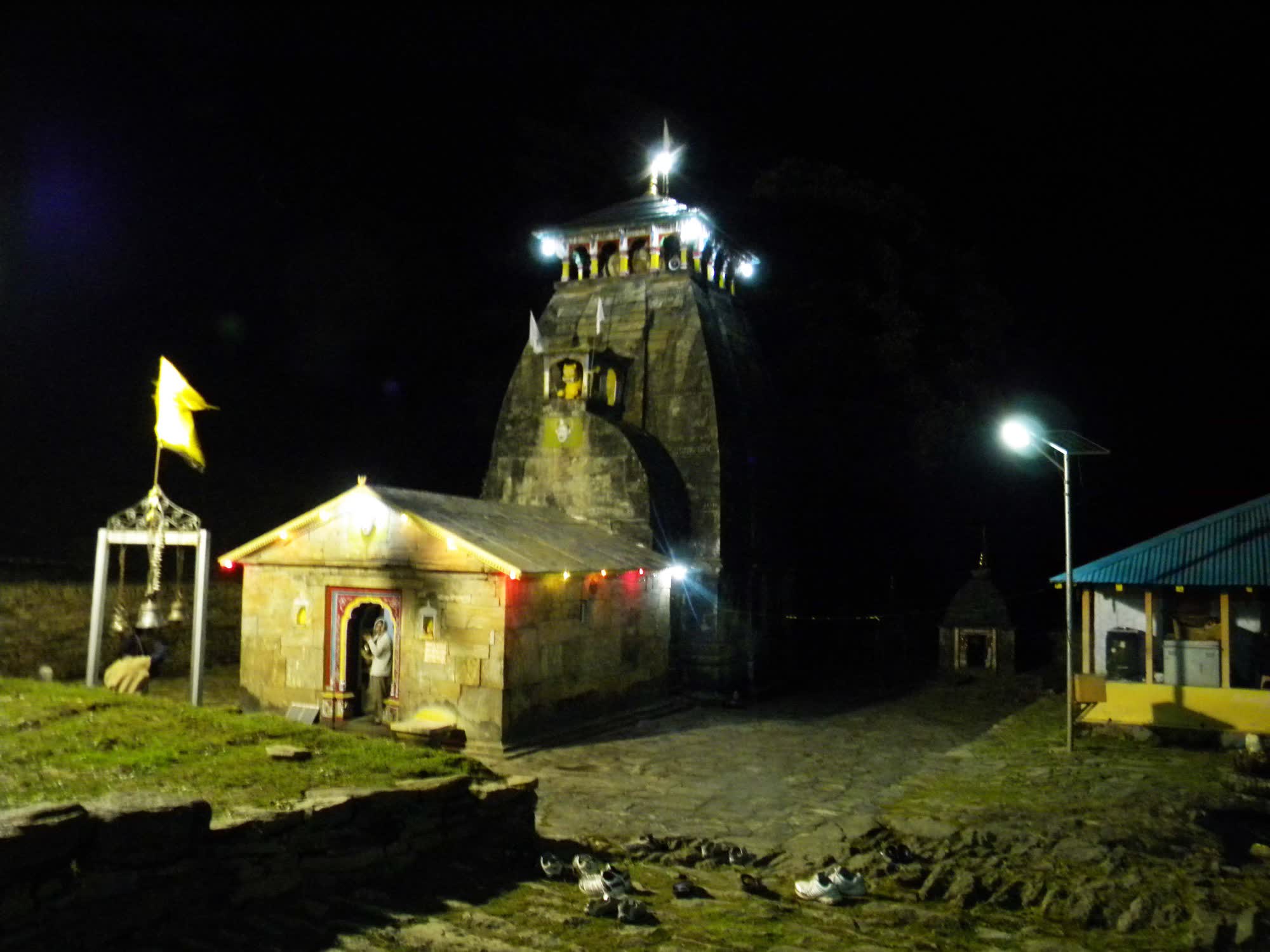
The navel and middle portion of the bull surfaced here, so the lingam is navel-shaped. The temple is built in the North Indian Nagara style. Beside it stand small shrines to Shiva–Parvati as Hara-Gauri, to Ardhanarishvara and to Saraswati.
The trail from Ransi drops to the river, then climbs through Gaundar, Bantoli, Khatara, Nanu and Kun Chatti. It passes oak and rhododendron forest and terraced fields, and the villages along it have homestays.
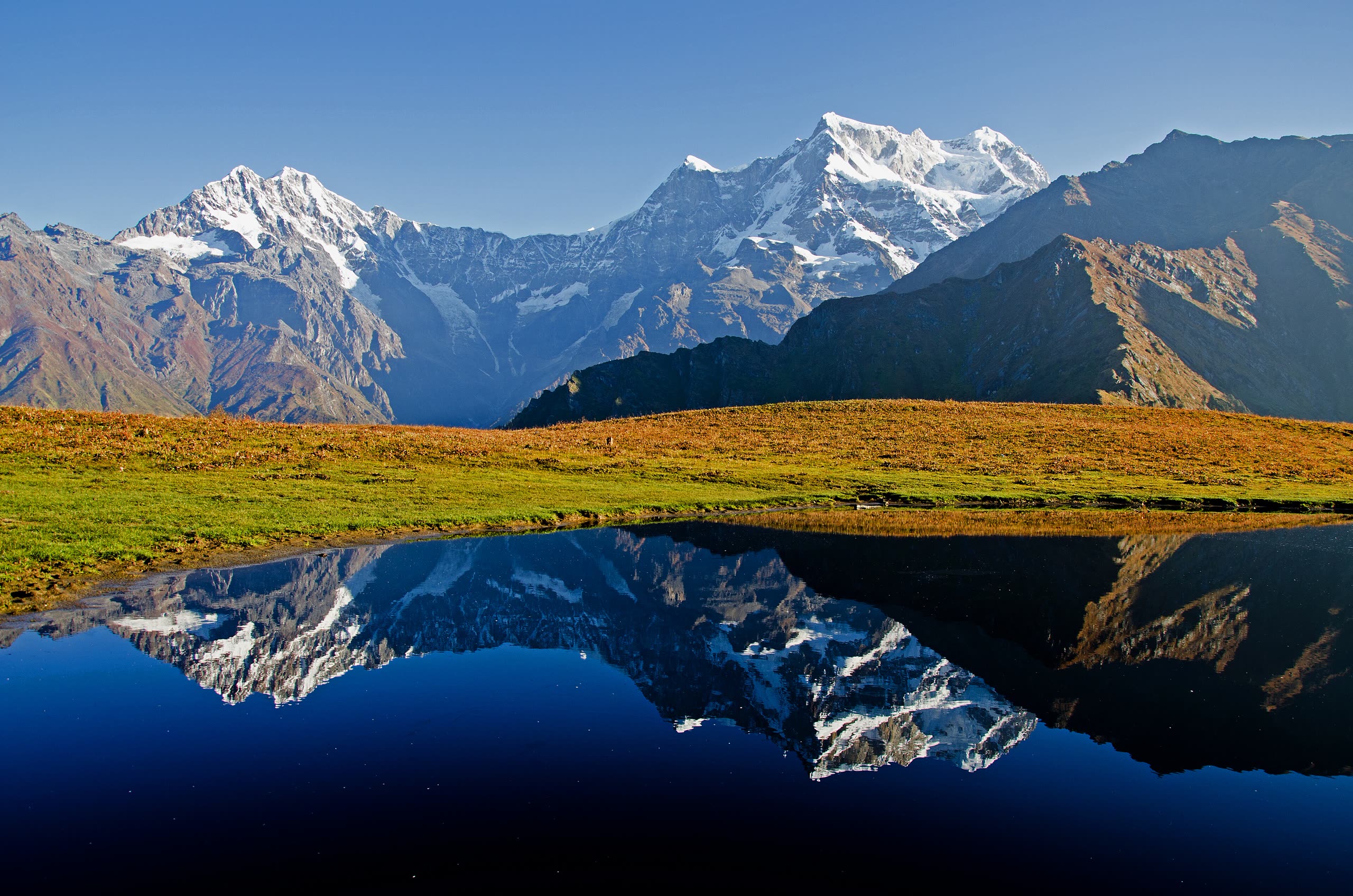
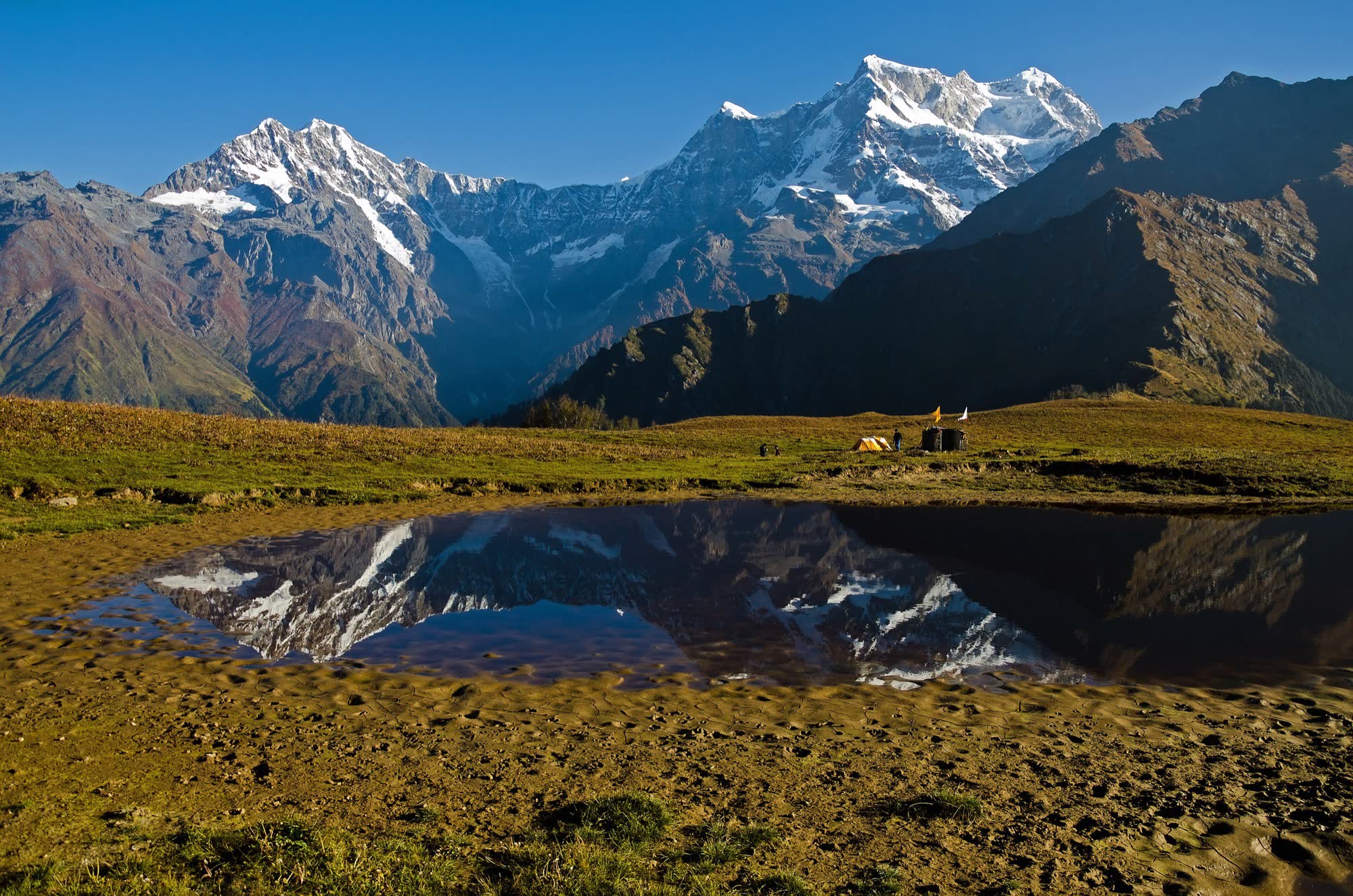
Two kilometres above the temple is Buda (Old) Madhyamaheshwar. This tiny shrine sits beside a pond, and on a still morning the pond mirrors Chaukhamba, Kedarnath and Neelkanth.
Important points
Navel-shaped lingam in a Nagara-style stone temple
Buda Madhyamaheshwar — Chaukhamba reflected in a meadow pond (2 km above)
Village homestays along the whole trail
Its water is considered so sacred that a few drops are said to be enough for a holy bath
About the altitude. Measured from SRTM satellite terrain data at the temple. The figure traditionally quoted is 3,497 m. Satellite terrain data is accurate to roughly ±30 m.
विस्तारIn detail
Madhyamaheshwar, in full detail
The building and its worship, the festivals, the trail stage by stage, month-by-month weather, facilities on the way, and the customs to know.
Madhyamaheshwar is a stone temple in the North Indian Himalayan style, often grouped with Kedarnath and Tungnath as Katyuri in form. It stands on a meadow just below a high ridge, with Chaukhamba to the north-west.
The garbhagriha holds a navel-shaped black stone lingam. Small subsidiary shrines stand beside the main temple, including those to Hara-Gauri, Ardhanarishvara and Saraswati.
Worship follows the same pattern as Kedarnath: a morning puja and aarti, darshan through the day with a short closure for bhog, and an evening aarti.
The priests are Jangams of the Veerashaiva tradition from Karnataka, like those at Kedarnath. In winter they continue the worship at Omkareshwar Temple, Ukhimath.
The temple is small and quiet, so darshan is unhurried. Remove shoes and leather outside, and keep your voice low in the sanctum.
April (Baisakhi)
Opening date announced
The opening date is usually fixed on Baisakhi at Omkareshwar Temple, Ukhimath, by consulting the panchang.
May
Doli yatra and kapat opening
The doli leaves Ukhimath and is carried up the valley over several days, halting at villages such as Ransi and Gaundar. Villagers come out with drums and offerings as it passes. The doors open on the fixed muhurat.
November (after Diwali)
Kapat closing
The doors close in November. The doli is carried down through Gaundar and Ransi to Ukhimath, again halting in the villages.
November (on the doli’s arrival at Ukhimath)
Madmaheshwar Mela
A fair held at Ukhimath to welcome the doli to its winter seat at Omkareshwar Temple. People come from across Rudraprayag district.
1
Ransi → Gaundar
≈ 6 km−170 m
A mostly downhill trail along the valley side, through forest and terraced fields. Gaundar has homestays and tea. Good shade.
2
Gaundar → Bantoli
≈ 1.3 km−30 m
Drops to the bridge at Bantoli, the lowest point of the walk. Homestays and water here.
3
Bantoli → Khatara
≈ 1.7 km+430 m
The hard part begins. A steep, stepped climb through oak forest. Shaded, but relentless.
4
Khatara → Nanu
≈ 2 km+350 m
Steady climbing through forest clearings. Tea stalls and homestays at Nanu.
5
Nanu → Kun Chatti
≈ 2.5 km+400 m
Continues up through oak and rhododendron. The last halt with tea before the meadows.
6
Kun Chatti → Madhyamaheshwar
≈ 2.5 km+220 m
The gradient eases as the forest thins and the meadow opens. The temple appears with Chaukhamba behind it. Little shade on this last stretch.
-12°C17°C
Jan≈ −10°C / ≈ −1°CTemple closed. Snow.
Feb≈ −9°C / ≈ 0°CTemple closed. Snow.
Mar≈ −6°C / ≈ 3°CTemple closed. Snow on the upper trail.
Apr≈ −2°C / ≈ 7°CTemple closed. Snow melting.
May≈ 2°C / ≈ 12°COpens in the second half of May.
Jun≈ 6°C / ≈ 15°COpen. Pleasant; showers from mid-June.
Jul≈ 8°C / ≈ 15°COpen. Monsoon — slippery trail, leeches in the forest.
Aug≈ 8°C / ≈ 15°COpen. Monsoon; meadows at their greenest.
Sep≈ 5°C / ≈ 13°COpen. Rain eases; clear views by late September.
Oct≈ 0°C / ≈ 10°COpen. Best views of Chaukhamba; cold nights.
Nov≈ −4°C / ≈ 6°CCloses in November. Approximate.
Dec≈ −8°C / ≈ 2°CTemple closed.
Approximate temperatures at the temple’s altitude (night / day). These are not weather-station records.
Medical aid
No medical post on the trail. The nearest health centre is at Ukhimath. Carry your own first-aid kit and personal medicines.
Mobile network
Usually available up to Ransi; little or none on the trail and at the temple. Tell family your plan before you leave Ransi.
ATMs & cash
The last ATMs are at Ukhimath. Homestays and stalls take cash; do not rely on UPI without signal.
Food on the trail
Village homestays and tea stalls at Gaundar, Bantoli, Khatara, Nanu and Kun Chatti, and simple meals at the temple. Food is home-style and vegetarian.
Ponies / palki / porters
This is mostly a walking trail. Mules carry supplies and can sometimes be hired, and porters can be found at Ransi, but neither is organised. Ask your homestay a day ahead.
Electricity & charging
Homestays in the villages usually have power, but supply can be limited at the temple. Carry a power bank.
Toilets
Only at homestays and lodges. None in between.
Drinking water
Springs and village taps along the trail. Treat or filter the water, or refill at homestays.
Do
Break the climb with a night at Bantoli, Khatara or Nanu.
Carry cash for homestays, food and offerings.
Start the climb from Bantoli early, while the forest is cool.
Treat your water or carry purification tablets.
Respect village homes and fields along the trail.
Don’t
Don’t attempt Ransi to the temple in one day unless you are a fit trekker.
Don’t walk the forest section after dark.
Don’t photograph inside the sanctum.
Don’t leave plastic or wrappers behind; nothing is collected on this trail.
Can I ride a mule to Madhyamaheshwar?
Not reliably. Mules on this trail mostly carry supplies, and riding animals are not organised as they are at Kedarnath. Plan to walk, and ask your homestay at Ransi if you need help with a load.
Who are the priests at Madhyamaheshwar?
Jangam priests of the Veerashaiva tradition from Karnataka, as at Kedarnath. They move with the deity to Omkareshwar Temple, Ukhimath, in winter.
Is there phone signal at the temple?
Usually not. Signal is generally lost after Ransi, so share your plan with family before you start.
When is the Madmaheshwar Mela?
In November, when the doli arrives at Ukhimath after the doors close. The exact date follows the closing date, which is announced each year.
Based on: BKTC (badrinath-kedarnath.gov.in) and BKTC announcements as reported in the press · Rudraprayag district website (culture and heritage: Madmaheshwar Mela) · Uttarakhand Tourism · Trek operator and route records (Bikat Adventures DIY guide and others) · Wikipedia (Madhyamaheshwar) for cross-checking.
कथाएँThe legends
The stories of Madhyamaheshwar
Traditional accounts, as told in the Puranas and by the temple communities. Versions differ from valley to valley.
The navel of the god
At Madhyamaheshwar, the “Lord of the Middle”, the navel and middle of the bull came up out of the earth. The lingam here is shaped like a navel. Tradition says Bhima built the first shrine, and worshipped here the god he had grabbed by the tail.
Water holy enough in a few drops
A spring flows beside the temple, and its water is counted among the holiest in the Himalaya. It is said to be so pure that a few drops sprinkled on the head are equal to a full ritual bath.
Pilgrims carry it home in small bottles for those who could not make the climb.
Buda Madhyamaheshwar — the Old Lord
Two kilometres above the temple, on an open meadow, stands a tiny shrine called Buda Madhyamaheshwar, the old Madhyamaheshwar. Villagers say it marks where the god was first worshipped, before the stone temple was built lower down.
Beside it lies a small pond that mirrors Chaukhamba and the Kedar peaks on a still morning. Many pilgrims feel it is the most peaceful place on the whole yatra.
The mela of the returning god
When the doors close in November, the doli of Madhyamaheshwar is carried down through the villages of the trail, through Gaundar and Ransi, to Ukhimath. There it shares the winter seat with Kedarnath.
Its arrival is celebrated with the Madmaheshwar Mela. Villagers from the whole valley come to welcome their god home for the winter.
Each trail is traced from OpenStreetMap footpaths, and its height is measured every 20 m from satellite terrain data (SRTM). The hiker walks that real profile on a 3D satellite map. Speed comes from Tobler’s hiking function, adjusted for altitude, your pace and rest stops. At every step you see altitude, gradient, oxygen and temperature, and at the end the time you reach the temple.
Meadow shrine and reflection pond with a full Chaukhamba panorama.
≈ 2 km
Gaundar village
Confluence of the Markanga and Madhyamaheshwar Ganga; first homestays.
≈ 6 km from Ransi
Omkareshwar Temple, Ukhimath
Winter seat of Kedarnath and Madhyamaheshwar.
≈ 20 km from Ransi
Kalimath
One of the most revered Shakti peeths of Garhwal.
≈ 25 km from Ukhimath
विश्रामWhere to stay
Stays for Madhyamaheshwar
Hotels at Ukhimath; homestays at Ransi, Gaundar, Bantoli, Khatara and Nanu; simple dharamshala rooms and homestays at the temple.
Madhyamaheshwar · Tungnath
Ukhimath
GMVN Tourist Rest House
Hotels & guest houses
BKTC dharamshala
Indicative / night₹1,000 – ₹3,500
Hub for Madhyamaheshwar and Tungnath. Has ATMs, pharmacy and fuel.
Madhyamaheshwar
Ransi · Gaundar · Bantoli · Nanu
Village homestays
Trail-side lodges
Indicative / night₹500 – ₹1,500
Simple rooms with home-cooked meals. Cash only.
Madhyamaheshwar
Madhyamaheshwar
Homestays
Temple dharamshala
Indicative / night₹500 – ₹1,500
A handful of rooms beside the temple meadow.
सुझावPilgrim tips
Break the climb at Bantoli or Khatara — it turns a hard day into two easy ones.
Carry cash. There are no ATMs beyond Ukhimath.
Go up to Buda Madhyamaheshwar at sunrise for the Chaukhamba reflection.
This website is managed by
The Office of MushroomWale.com
A free, independent guide for Panch Kedar pilgrims, prepared and maintained from Uttarakhand. Temple bookings and donations go only through official channels — this site never collects money.